
Anterior
Valentine’s Day 2023 in Malaga: Love in the Most Premium Mood

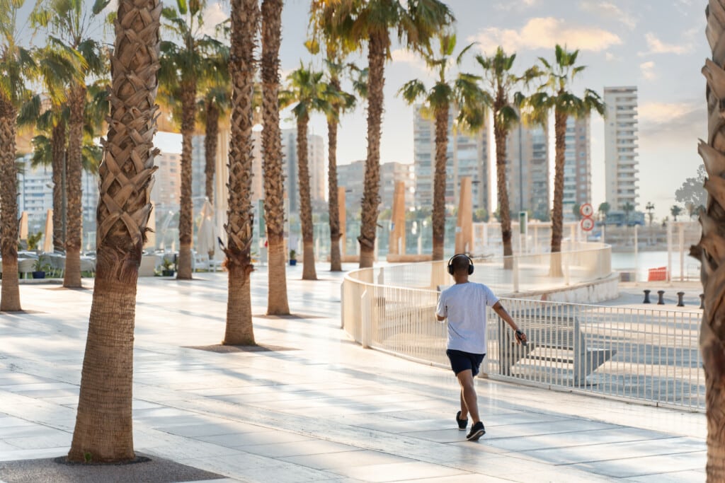
It’s no secret to runners that Malaga is home to some great running routes. Important sporting events such as the Marathon, the Half Marathon, the Ciudad de Málag urban race, and other great classics, such as the El Torcal – La Paz or the Mini-Maratón Peña El Bastón, clearly show locals and visitors from all over the world that Malaga is a place where you can run at pleasure. Thanks to urban environments that allow for improvised running routes in the centre of Malaga and its neighbourhoods and the option of being in the heart of nature in a few minutes, your visit to the Costa del Sol can also be a fantastic opportunity to discover the city on foot. Come on up!
Why Run in Malaga?
Best Running Routes in Malaga
Downtown-La Malagueta
Pedregalejo
Gibralfaro
La Virreina Forest Park
La Concepción Forest Park
With a 12 km long continuous seaside walk, you can admire the Bay of Malaga on a jogging path scattered with toilets, fountains, small urban fitness stations, and, of course, a lot of history. In 2022, the Malaga Half Marathon passed into account for being standardised as Europe’s second flattest 21 km race. Is that not enough reason to run in Malaga?

But that’s not all. Suppose you are looking for running routes on your visit to Malaga because you want to get away from the hustle and bustle of the city. In just a few minutes, you can trot through the natural landscape of the Guadalhorce river mouth or run under the shadow of the pines of the Natural Park Montes de Malaga. In that case, it is also important to remark that the pine forests of Monte de Gibralfaro and Monte Victoria are right in the center of Malaga. You will find trails that will test your endurance and treat you with breathtaking views from the Gibralfaro Castle towards the Bay of Malaga, the Alcazaba, the Plaza de Toros, and the whole historic centre.
For all those who, when going on a trip, think about running routes and pack their running shoes in their suitcases (needless to say that forgetting them would be a real mess), here is our unique selection for discovering Malaga the way we love it most: running. But not rushing!
Distance: Short
Terrain: Urban
Profile: Flat

This running path is an essential one in Malaga. It doesn’t matter which of our holiday apartment buildings you will be staying in. Only a few metres away from Calle Granada and Calle San Telmo, you will find the Plaza de la Constitución, the departure point of this running route that will allow you to discover Malaga with the help of Grupo Premium. Walk through the stylish Calle Larios, the capital’s most renowned street, and an outdoor shopping centre. When reaching Alameda Principal, turn to the left towards Paseo del Parque (Northside).
Take the chance to gaze at the cathedral and discover the antique Palacio de la Aduana, which nowadays is home to the Malaga Museum. Up ahead, three magnificent buildings complete the walkway: The Rectorado (Vice-Chancellor’s Office) of the University of Malaga, the headquarters of the Bank of Spain, and the City Hall, which is fondly known by locals as “The Big House by the Park.” At the end of the park, you will find the Fountain of the Three Graces, the bull ring (currently the Malagueta Cultural Centre), and beautiful views of the Alcazaba and the Castle of Gibralfaro.
At this point, our running path is approaching the Paseo Marítimo Antonio Banderas y Pablo Ruiz Picasso. Just take a selfie next to the Malagueta sign and run until the T-shaped breakwater. Refuel under the shade of the palm trees, or work out your strength in the calisthenics gym.

It’s time to walk back to the Plaza de Toros. From here, we return along the Paseo del Parque (South side), where we will probably find a gastronomic, handicrafts, or book fair. You’ll find a little donkey statue in the Platero playground, an homage to Juan Ramón Jiménez’s masterpiece. Once we get to the Plaza de la Marina, we only have to go up Calle Larios and cheer our victory in the Plaza de la Constitución.
This is such flat terrain, with paved ground and broad avenues. Even on the busiest days, enjoying yourself while running will be easy. Be extremely careful at road crossings! You will cross some of the city’s main roads, which can be congested.
Distance: medium
Terrain: promenade
Profile: flat
One of the most marine running routes in Malaga. If you want to discover the Malaga capital’s fishermen’s quarter par excellence, you’re in the right place. We could take this route as an extension of our previous proposal. Indeed, a part of this second running path in Malaga lies not far from where the Malaga Marathon passes.
This path starts in the surroundings of the Balneario de los Baños del Carmen. On this historical beach in the capital, you will find the remains of the spa that used to be a meeting point for high society from all over the country at the dawn of the last century. The connoisseurs also claim that one can enjoy the most beautiful and authentic Malaga sunsets here.
Yet we’re here to run, aren’t we? Start the route east to find access to the Pedregalejo promenade. This promenade is a trendy place for running lovers in Malaga. With a length of more than 1 km, it surrounds six small (artificial) small bays, a popular bathing spot for local residents and families from all over the city.

If we continue our path in an eastern direction, we will cross a bridge over one of the capital’s streams and then enter the Palo district, always without leaving the promenade.
El Palo is the core of fishing in Malaga. A district dedicated to the sea and its traditions. We can enjoy the sea breeze on the walk, but we will also ” suffer” the smell of the sardines roasted on skewers in boats located in the sandy area. Who will be able to endure those last running kilometres along the promenade of Malaga?
If you don’t want to run out of the capital, you can always retrace your steps when reaching Marina Puerto del Candado. A charming harbour from where you can contemplate the Bay of Malaga to the West and the coasts of the Axarquia to the East.
If, as we recommend, you turn this running path in Malaga into a circular one, you will end up on the beach of the Baños del Carmen, from where you will enjoy the above-mentioned Malaga sunset, with the lights of the city reflected on the quiet waters of the Bay and the tower of the Cathedral rising above the Gibralfaro Mountain.
Distance: short
Terrain: urban + trails
Profile: mountainous
Now we introduce you to a running path through Malaga and its history. More than 2,000 years of history are condensed into just 3 kilometres. A journey with high and low points, like any story, but one that will surprise everyone. A different and original way of discovering the historic centre and getting ready for your visit to the city.
Stand in the glass pyramid on Alcazabilla Street, next to the Roman theatre. Enjoy the remains of the Roman city’s salting factories and admire the ruins of the theatre. You will feel like a gladiator about to face the physical challenge that means this running path in the centre of Malaga. Let’s get started!
Head north towards Plaza de la Merced. In the 15th century, it was the market square. Centuries later, it would witness the birth of one of Malaga’s most universal citizens: Picasso. Go clockwise around the square and enter Mundo Nuevo Street from Victoria Street. Here the path starts to climb along a track that turns into a forest road in a few metres. As we zigzag under the pine forests of the Gibralfaro mountain, we will reach a height of almost 120 metres. The path joins the Camino de Gibralfaro and leads to the entrance gate to the castle. If you cross the parking lot and leave the gate behind you, you can continue this path and run under the building wall that frames the panoramic view of Malaga.

Now, walk down the paved path with many viewpoints until you reach the Mirador de la Coracha. You can enjoy stunning views of Malaga Town Hall and the Alcazaba from here. Go down through the Puerta Oscura Gardens and end the path at the Museum of Malaga, next to Alcazabilla Street, where our challenge begins.
Refresh yourself at the Batik restaurant of Hotel Alcazaba Premium and discover an excellent view of the path you have just completed. Do you fancy another running path?
Distance: short
Field: dirt roads
Gradient: moderate with light slopes
If you are looking for running routes in Malaga that go through trails and countryside areas, you should definitely try La Virreina Forest Park. It is a natural site of some 400,000 square metres, accessed from Avenida de Jane Bowles, in district no. 5 Palma-Palmilla.
This large forest area, located to the north of Malaga, has up to 8 viewpoints, spacious picnic areas, and signposted hiking trails. In addition, during your hike, you will be able to observe a great diversity of vegetation with an abundance of pines, wild olive trees, carob trees, broom, and many other species. Moreover, as a running route in Malaga that goes into the countryside, you will also enjoy the company of some animals, such as rabbits or birds.
You will also be pleased to know that a pedestrian footbridge has recently been installed, which connects the different slopes of the forest area and makes it easier to cross on foot. In addition, this Malaga trail for running has light hills and excellent views of the north of the city, making it the perfect place to enjoy a relaxed run in nature without sacrificing a certain level of difficulty. We want to get a bit fit by doing sport, don’t we?

We start the route from the Avenida de Jane Bowles and head towards Calle Conrad Adenauer towards the Camino de las Erizas, where the actual forest route begins. We continue the trail along the Camino de las Erizas until we reach the Camino Mendelín, which turns from a straight path to a track with slight curves and slopes along the way. A bit of action doesn’t hurt either, does it? We follow the route towards the Camino del Corcel and come across the first photographic point, at an altitude of 223 m, from which we can see the city of Malaga, with the Manquita in the distance and the Mediterranean Sea in the background. It is an ideal view to take some pictures and rest a bit. We continue our route along a winding path and take the turn to the left in the direction of Riberillo, where a dirt track surrounded by many species of vegetation awaits us. Later on, the path splits again, and we will take the path to the left, in the direction of Lagar de Luciano, where we will see a slight slope surrounded by trees that are perfect for exploring. Finally, we will arrive at the viewpoint of the El Limonero reservoir, from where we can see the El Limonero dam and, in the distance, Ciudad Jardín and the Botanical Garden. From here, our circular route descends parallel to the Caminos del Corcel and Caminos de las Erizas until we reach the starting point in Avenida de Jane Bowles.
If you liked this easy Malaga running trail in the north, wait until you see other similar courses, such as the one in the La Concepción Forest Park.
Distance: short
Field: dirt roads
Gradient: moderate with light slopes
Ready for a new forest route on dirt tracks and country areas? On this occasion, we will take a circular route through the El Limonero reservoir and the La Concepción Forest Park. This is an easy run of moderate difficulty with some light hills, suitable for all levels of fitness. It also has multiple paved tracks, and its starting point is next to a car park, which makes it very convenient to leave the car and start the route. Let’s know this beautiful Malaga running route!
La Concepción Forest Park has a surface area of 190,000 square metres. It is located next to the Botanical-Historical Garden of La Concepción, in the north of the city, and is crossed by the Guadalmedina River. It has a large recreational area where picnics and barbecues can be held. For these, there are two areas, one next to the chapel and the other next to the coloured bridge. It is in these areas that the district of Ciudad Jardín celebrates its annual Romería de la Alegría in September. In addition, the area of the El Agujero reservoir and the El Limonero dam is outstanding for its incredible beauty and is often visited by nature lovers. At its highest point, there is a viewpoint from which to contemplate the reservoir and the surrounding areas. Also, if you walk this route with the little ones, you can go to the bird observatory and the children’s playground with a swing, slide, and seesaw. Can you think of a better way to do sport and enjoy the outdoors with your family?
With a distance of less than 5 km, which can be covered in half an hour, this running route in Malaga is perfect for beginners. Here, you will walk along excellent dirt trails, see a wide variety of flora and fauna, and enjoy incredible views of the north of the city, the El Limonero Reservoir, and the La Concepción Botanical-Historical Garden.

Before starting the forest walk, if you have the opportunity to visit the Botanical Garden, it is worth taking the chance to see its beautiful spots, made up of many shady areas where you can escape from the heat of Malaga. Let us now begin this circular route in La Concepción Forest Park itself, where we find a perfect parking area, and continue to the left in the direction of the Puente de Colores (Coloured Bridge). On this route, we will enjoy a pleasant walk along paved paths surrounded by lush vegetation, and we will pass by some nice picnic areas. We follow the path in the direction of the El Limonero reservoir and begin an ascending route. Further on, the path splits off to the left, where you will find the viewpoint over the reservoir. This is the bird observatory at the El Limonero reservoir, and we recommend you visit it, as the views are breathtaking and well worth the effort. After this break in the path, we return to the original path and continue ascending towards the El Agujero dam, where we can stop to rest, drink water, and take photos of the dam. At this point, we proceed with the return journey of this circular route. We continue to the right towards the Haza Carpintero Citizens’ Centre, next to another picnic area. Finally, we follow the path straight downhill to the starting point, in the car parks of La Concepción Park. Do you fancy another Malaga running route?
Valentine’s Day 2023 in Malaga: Love in the Most Premium Mood
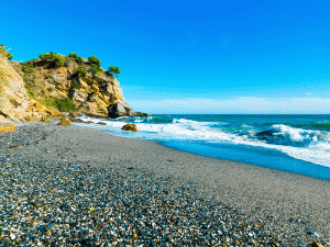
Discover the Best Beaches in Malaga Where You Can Enjoy Your Favourite Plans All Year Round

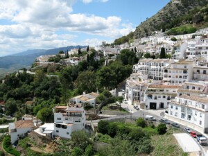
Discover the Most Charming Malaga Villages to Visit All Year Round
1 week agoDo you know the most charming Malaga villages? As you already know, our city is the ideal destination to relax on the... Leer más
Enjoy the Malaga Holy Week 2024 with Apartamentos Málaga Premium Complete Guide
5 months agoDo you want to enjoy the Holy Week 2024 in Malaga? Would you like to discover all the details so you do... Leer más

La Terraza del Quizás: Your New Rooptop Bar for Events in Malaga
8 months agoAre you looking for a rooftop bar for events in Malaga? You’re in luck because, at Apartamentos Málaga Premium, we have the... Leer más
Discover the Most Charming Malaga Villages to Visit All Year Round
9 months agoDo you know the most charming Malaga villages? As you already know, our city is the ideal destination to relax on the... Leer más

Christmas 2023 in Malaga Arrives Packed with the Most Premium Ideas
9 months agoAre you ready to celebrate Christmas 2023 in Malaga? If you are wondering where to celebrate your business meal, want to bring... Leer más

Discover the Most Charming Malaga Villages to Visit All Year Round
1 week agoDo you know the most charming... Leer más

Enjoy the Malaga Holy Week 2024 with Apartamentos Málaga Premium Complete Guide
5 months agoDo you want to enjoy the... Leer más

La Terraza del Quizás – Your rooftop terrace for top events
6 months agoWhen it comes to organising a... Leer más

Easy hiking trails – Discover Malaga at its most active
6 months agoApartamentos Málaga Premium, with its comfort... Leer más

La Terraza del Quizás: Your New Rooptop Bar for Events in Malaga
8 months agoAre you looking for a rooftop... Leer más
Únete a la conversación